
REVIEW · USA HIKING TOURS
Richmond: Guided Hike in James River Park
A wild river runs through downtown Richmond. This 150-minute guided hike makes the most of it, linking rushing James River rapids, pedestrian bridges, Civil War and industrial ruins, and the unusual Pipeline Walk. I especially like the contrast between city and nature, plus the chance to see Richmond from low river-level paths rather than only from streets and overlooks.
I also like the tour’s thoughtful route through Belle Isle, Brown’s Island, and Manchester Climbing Wall Park, with each stop showing a different side of the riverfront. The main consideration is physical effort: this is a 4.5-mile hike with stairs, rocks, dirt paths, and a small ladder, so it is not suited to people with mobility impairments or wheelchair users.
Key points at a glance
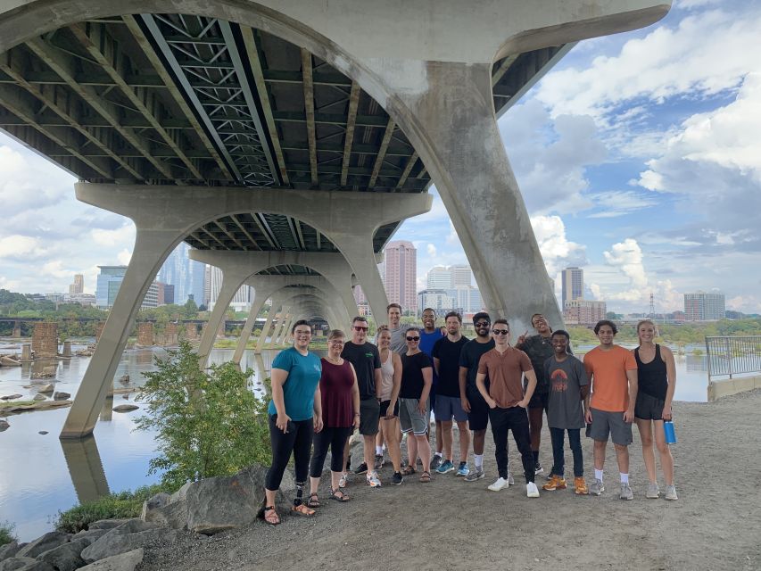
- 4.5 miles through a city park system: Expect a real hike, not a short stroll, with mostly dirt and paved paths.
- Class IV rapids from pedestrian bridges: The James River provides the tour’s biggest visual payoff, especially from the bridge crossings.
- Manchester Climbing Wall Park: Old train bridge ruins now form part of an unusual recreation area.
- Belle Isle’s industrial and wartime remains: Nature grows around structures linked to Richmond’s past.
- Pipeline Walk on Brown’s Island: A narrow, secluded route offers a particularly unusual view of the river.
- Good value at $35: The price includes a live English-speaking guide and two and a half hours of interpretation and walking.
Why this riverfront hike is different from a city tour
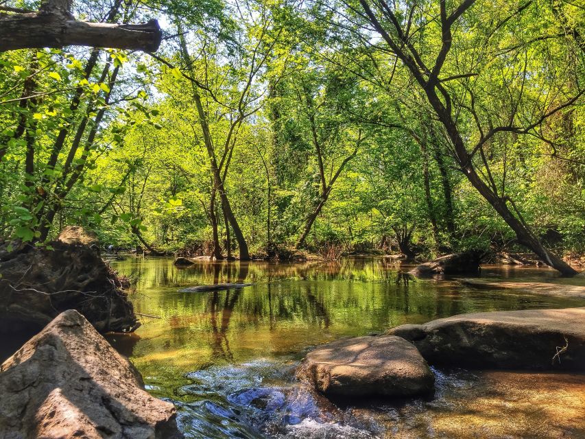
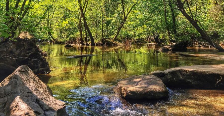
Richmond’s downtown riverfront is not simply a paved promenade beside calm water. The James River cuts through the city with exposed rocks, rushing rapids, wooded paths, old structures, and pedestrian bridges. This outing uses those features as the main attraction.
I like the way the route joins several separate parts of the riverfront into one outing. You cross the river, pause above the rapids, walk through Manchester Climbing Wall Park, continue across Belle Isle, and then reach Brown’s Island and the Pipeline Walk. That progression gives you changing views instead of repeating the same riverbank scenery.
The guide adds context that you would miss on a self-guided walk. The ruins are not just old concrete and stone. They connect the river to transportation, industry, wartime use, and the city’s changing relationship with the James. Guides Lori and Laurie have received particularly warm praise for being friendly, clear, and willing to answer questions.
This is a good choice if you want Richmond outdoors, with enough history to give the scenery meaning. It is less suitable if you want a relaxed stroll, a purely historical tour, or a route that avoids uneven ground.
More Guided Day Hikes in the USA
- Multnomah Falls and Columbia River Gorge Half-Day Hiking Tour
★ 5.0 · 2,108 reviews - Valley of Fire Guided Hike from Las Vegas
★ 5.0 · 1,611 reviews - Wailua River Kayak and Sacred Falls Guided Hike with Lunch
★ 5.0 · 783 reviews
Starting at the Manchester Climbing Wall parking lot
The meeting point is the paved sidewalk trailhead leaving the Manchester Climbing Wall Parking Lot. This detail matters because the tour departs right on time, and parking may take longer than expected.
Use Google Maps and enter Manchester Climbing Wall Parking Lot or the supplied address exactly as directed. The address can appear incorrectly in Apple Maps, Waze, and other navigation apps, where it may show only US-60 E. If the lot is full, you will need to search for street parking nearby.
Give yourself plenty of time. Arriving early is much better than turning the first part of the hike into a stressful parking search. You should also arrive ready to walk, with water already packed and comfortable shoes on.
The $35 price covers the guided tour of the James River Park System. Food, water, sunscreen, and bug repellent are not included. For a two-and-a-half-hour outing, that is a fair price if you value a guide’s local explanation and want a planned route through several riverfront areas.
Crossing the James River above the rapids

The tour begins by crossing the James River on a pedestrian bridge. The bridge creates an immediate sense of place. Instead of seeing the water from a distant road, you look down at the river moving through rocks and rapids.
The rapids are described as Class IV, so the water has real force. You will pause to take in the rushing current and the surrounding area before continuing. This is one of the strongest parts of the route because it shows why the James is central to Richmond’s identity. It is scenic, but it is also active and powerful.
The bridge crossing also gives you a different view of downtown. The experience is not limited to trees and trails. You get a close look at the meeting point between the urban core and the river corridor, with the city nearby but the water and rocks drawing your attention.
Your guide’s role is useful here. A good explanation can turn a quick photo stop into a clearer understanding of how Richmond developed around the river. Since the tour is conducted in English, you should be comfortable following spoken explanations and asking questions in English.
Manchester Climbing Wall Park and its train bridge ruins
Next comes Manchester Climbing Wall Park, built on the remains of a train bridge dating back about 150 years. This is an inventive use of old infrastructure. The ruins are not presented as a polished monument. Instead, they form part of a recreation area, showing how an obsolete transportation structure can find a new purpose.
I find this one of the most distinctive stops because it combines engineering, history, and outdoor activity in one place. You can see how the old bridge once served the industrial riverfront, while the climbing wall gives the same structure a modern role.
The site also helps explain why this hike feels more substantial than a standard nature walk. You are not simply walking through woods. You are moving through layers of Richmond’s past and present, with the guide pointing out how the riverfront has changed.
The terrain begins to matter here. The route includes mostly dirt and paved paths, but occasional stairs and rocky sections require steady footing. Comfortable walking shoes are essential. Sandals or smooth-soled casual shoes could make the rougher portions less pleasant.
Same trailhead, a different kind of day:
- Lower Antelope Canyon Hiking Tour
★ 5.0 · 6,216 reviews - Small Group: Valley of Fire Half Day Tour from Las Vegas
★ 5.0 · 2,130 reviews - San Francisco: Yosemite National Park & Giant Sequoias Hike
★ 4.5 · 1,777 reviews - Los Angeles: The Original 2.5-Hour Hollywood Sign Hike
★ 5.0 · 1,468 reviews
Belle Isle’s ruins and quiet trails

From the Manchester area, the route continues along Belle Isle. The trails pass remains connected with the Civil War and Richmond’s industrial period. These structures give the island a sense of time without turning the hike into a formal museum visit.
The appeal is in the contrast. One moment you are close to the city and the river’s loud current. The next, trees and quieter paths create a more secluded feeling. The ruins appear along the route as reminders that this was once a working and contested place, not simply a park for recreation.
You should expect interpretation rather than a long stop at every structure. The guide can help you understand what you are seeing, while the walking route keeps the experience moving. If you want detailed military history or extensive time for close inspection, this tour may feel too active. If you prefer history folded into an outdoor route, the balance works well.
Belle Isle is also where the hike’s physical nature becomes clear. You will cover several miles, and the mix of trail surfaces requires attention. There may be stairs, uneven ground, and rocky patches. The tour is manageable for a regular walker who is prepared, but it is not designed for someone seeking an easy, flat path.
The second bridge and Brown’s Island’s Pipeline Walk
After Belle Isle, you cross a second pedestrian bridge to reach Brown’s Island. This second crossing adds another useful viewpoint over the James and helps the route feel like a connected river circuit rather than a walk in one park.
The final major feature is the Pipeline Walk. This repurposed industrial route is narrower and more secluded than the open bridge crossings. It offers unusual vantage points along the river and gives you a closer sense of the infrastructure that once supported Richmond’s working waterfront.
The Pipeline Walk is a fitting finish because it brings together the tour’s main themes: water, industry, repurposed structures, and access to places that are easy to overlook from city streets. The setting feels different from Belle Isle, even though both are part of the same riverfront system.
This section may include the small ladder mentioned in the route details, about five rungs. It is not a major climb, but it is important to know about before booking. If ladders or narrow paths make you uncomfortable, ask the provider for current route guidance before reserving.
What the guide adds to the experience
The guide is the reason to choose this tour instead of simply downloading a map and walking the park yourself. The route includes several places where a short explanation adds real value, especially the train bridge ruins, Belle Isle structures, and the Pipeline Walk.
The strongest praise has gone to guides Lori and Laurie. They are described as friendly, engaging, and well informed, with a willingness to answer questions. That matters on a walk like this because the best moments are not only the obvious views. They are the small connections between a ruin, a bridge, a trail, and Richmond’s past.
A guide also helps with pacing and route-finding. James River Park has a mix of paths and structures, and the tour links several areas in one outing. You can spend your attention on the river and surroundings instead of checking your phone at every turn.
Still, your experience can vary with weather, group pace, and the guide’s style. The route is structured, but it is not a private custom tour. If you need long photo stops or a highly specialized focus, tell the guide early so expectations are clear.
Physical demands, weather, and what to bring

Plan for a genuine 4.5-mile hike lasting about 150 minutes. Most of the route uses dirt or paved paths, but stairs, rocky terrain, and a small ladder make it more demanding than the mileage alone suggests.
Bring:
- Comfortable shoes with good traction
- Water
- Weather-appropriate clothing
- Sunscreen
- Bug repellent
Sunscreen and bug repellent are not included, and neither is water. You should carry enough water for the full outing because the tour does not include food or drink stops.
The activity does not operate in heavy rain or other inclement weather. Even in fair conditions, weather-appropriate clothing matters because the route moves between open bridges, wooded paths, and exposed river views.
This is not suitable for wheelchair users or people with mobility impairments. The uneven surfaces, staircases, rocks, and ladder make that limitation important, not a minor footnote. If you have an injury or condition that affects balance or endurance, ask detailed questions before booking.
How the $35 price compares with the experience

At $35 per person, the tour offers a solid return if you want local guidance and a well-connected route. You receive 150 minutes with a live English-speaking guide, access to several sections of the James River Park System, and interpretation of sites that can be easy to pass without understanding.
The value is less about luxury and more about efficiency. You could visit parts of Belle Isle, Brown’s Island, and the Manchester area independently, but you would need to plan the route, locate the pedestrian crossings, and research the ruins. The tour puts those pieces together.
It is not the best value for someone who already knows the riverfront or prefers to walk at a completely independent pace. It is also not a short orientation walk. You are paying for a fairly active outing with a clear route and a guide who can answer questions.
Free cancellation up to 24 hours before the start provides useful flexibility, and the reserve-now, pay-later option can help if your Richmond plans are still changing. Those policies are practical, but the main value remains the route and the guide.
Who should book this Richmond hike?
I would recommend this tour to:
- First-time visitors who want to see Richmond beyond downtown streets
- People who enjoy moderate urban hikes with history along the way
- Anyone interested in old transportation and industrial remains
- Photographers looking for river, bridge, ruin, and rapid views
- Local residents who want a fresh way to explore the city
- Active couples, families with suitable older children, and small groups comfortable walking several miles
I would think twice if you want a flat, effortless walk, have limited mobility, dislike uneven ground, or prefer a tour focused only on architecture or Civil War history. The route’s strength is its mix of nature, water, infrastructure, and local stories.
Should you book the James River Park hike?
Book it if you want a moderately active way to understand Richmond’s riverfront in one outing. The Class IV rapids, old train bridge ruins, Belle Isle trails, and Pipeline Walk create a varied experience, while the guides add the context that makes each stop more than a photo opportunity.
Before booking, check the weather, pack water, and allow extra time for parking. If you can comfortably handle 4.5 miles, stairs, rocky paths, and a five-rung ladder, $35 is a reasonable price for two and a half hours of guided exploration. If you need an accessible route or a gentle stroll, choose another Richmond activity.
FAQ
How long is the James River Park guided hike?
The hike lasts 150 minutes, or two and a half hours.
How far does the hike go?
The route is 4.5 miles long.
Where does the tour meet?
The meeting point is the paved sidewalk trailhead leaving the Manchester Climbing Wall Parking Lot.
Which map app should I use to find the meeting point?
Use Google Maps and enter Manchester Climbing Wall Parking Lot or the provided address. Apple Maps may display only US-60 E, and the supplied directions specifically advise against using Apple Maps, Waze, or other navigation apps for this location.
What places does the hike visit?
The route includes a pedestrian bridge over the James River, Manchester Climbing Wall Park, Belle Isle, a second pedestrian bridge, and the Pipeline Walk on Brown’s Island.
What should I bring?
Bring comfortable shoes, water, and weather-appropriate clothing. Sunscreen and bug repellent are also recommended because they are not provided.
Is the hike suitable for wheelchair users?
No. The route is not suitable for wheelchair users or people with mobility impairments.
Does the route include stairs or a ladder?
Yes. The hike can include staircases, rocky terrain, and a small ladder of about five rungs.
What happens in heavy rain or bad weather?
The activity does not take place in heavy rain or other inclement weather.
Just added around the USA
- Strawberry Hill and Downtown KCK Hike★ 5.0 · 18 reviews
- Kansas City Crossroads Art District and Westside Urban Hike★ 5.0 · 22 reviews
- Mendenhall Glacier Guided Hike Juneau★ 5.0 · 125 reviews
- Juneau Shore Excursion: Mendenhall Glacier Canoe, Paddle and Hike★ 5.0 · 75 reviews
- Juneau Shore Excursion: Mendenhall Glacier Guided Hike★ 5.0 · 71 reviews
- Rainforest & Waterfalls Trek★ 5.0 · 35 reviews
- Norris Adventure: Seaplane, Paddle and Glacier Hike★ 5.0 · 12 reviews
- Diamond Head and Manoa Falls Hike and Adventure Tour★ 4.5 · 15 reviews
USA Hiking Tours, compared.


Small Group: Valley of Fire Half Day Tour from Las Vegas
Read our review →
Multnomah Falls and Columbia River Gorge Half-Day Hiking Tour
Read our review →
Yosemite National Park & Giant Sequoias Hike
Read our review →


Kauai Adventure: Kayak & Hike to Secret Falls with Expert Guide
Read our review →Browse the lists this tour appears in